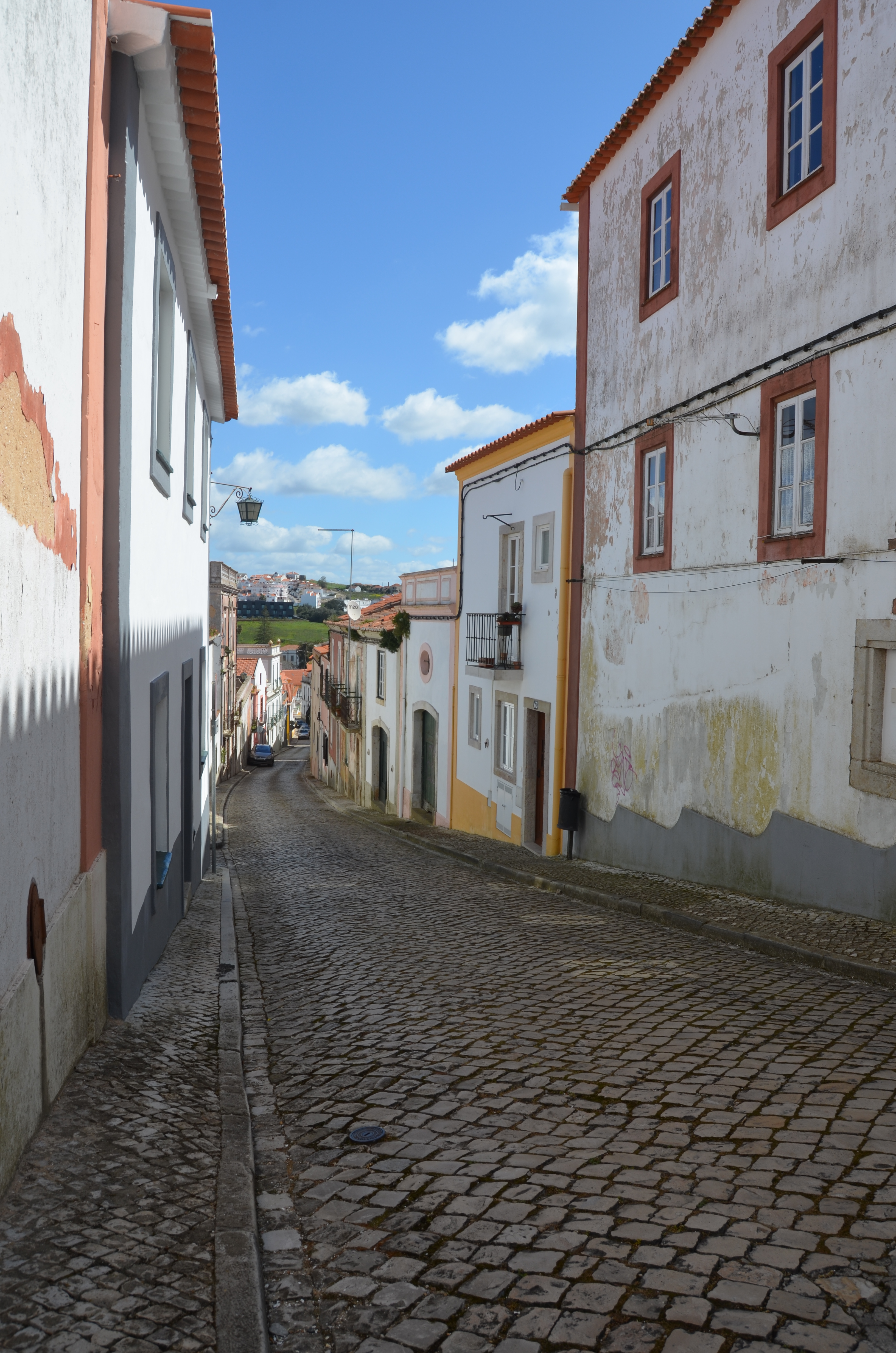
The Historical Centre of Cercal do Alentejo “has a sinuous and serpentine layout, which flows suddenly into arable land or olive groves, from which only the rows of houses separate us.
An organic yet rational layout, since it optimizes the direct link to the arable land, forming in the process thoroughfares where buildings have been constructed in bands, thus allowing a neighbourhood, ready sociability and mutual aid and also a back yard, so important to store tools, animals or grow mimosas – thus forming the other characteristic of the urban fabric of Cercal.
Buildings in bands, turning confluent channel-space into meeting points, such as the junction, the crossing, the square. At its heart the confluence of the streets creates the street-yard, predecessor of the orthogonal bourgeois city block. The yard develops radially towards the farmland.
The network thus empowers and is fruit of the economic activity that has been predominant for centuries in Cercal – agriculture. In fact, this primitive and more sedimented centre is removed from a traditional unifying pole – the church, only recently surrounded by the village, as according to the testimony of Father Cardoso, “the parish dedicated to Our Lady of Conception is away from the people”.
In earlier times it must have had a bigger square, or rossio, the toponymic traces of which still exist, possibly occupied by the irregular block that does not fit into this radial network – structured and defined by the daily life of the rural population.
The occupation in bands also spilled over into the most important roads connecting Cercal to other villages, especially towards the south, on the road connecting the Algarve to Setúbal, in good working order since the time of Queen Mary.


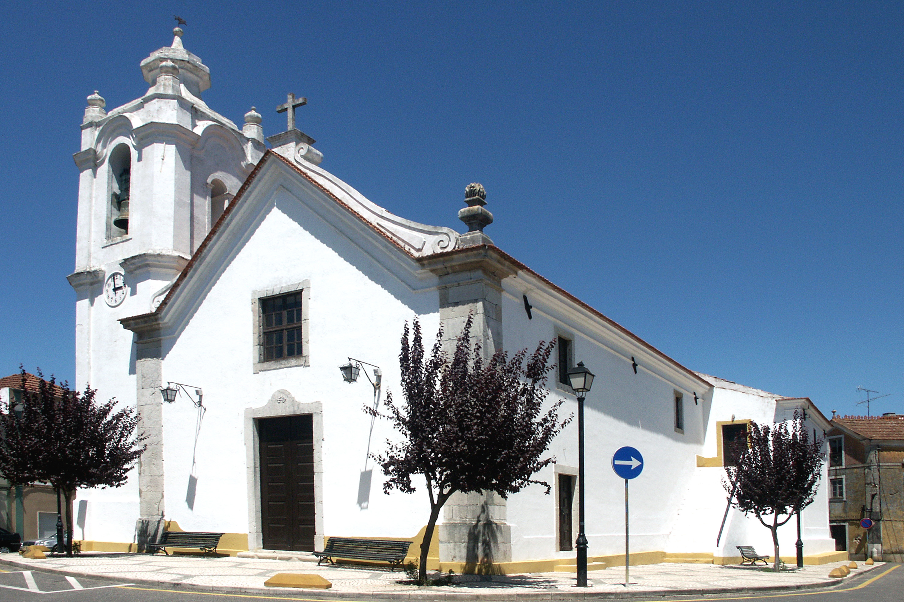


The Historic Centre of Alvalade is the size of the village as it was around a hundred years ago. It includes, of course, its oldest centre, where architectural remnants of the Roman period can be seen. “Rua de Lisboa, where the first houses were built in the vicinity of the fifteenth-century Mother Church, a temple that must have been refurbished several times, but which corresponds from a symbolic point of view to the foundation of the parish, with the old cemetery in the churchyard and jutting out over the vast and fertile plains of Campilhas and Sado.” “The urban fabric of the historic centre, medieval in character, has as its centre Praça D. Manuel I, the heart of the village. It represented the civic centre of the village where the main institutions were located. In the centre of the Praça stands the Manueline Pillory dating back to the sixteenth century, the sixteenth-century chapel of Mercy in a Mannerist style and the former Town Hall building.”


The Historic Centre of Santiago do Cacém “is located on the eastern slope of the Castle hill, a building attributed to the Islamic period which forms a monument complex with the eighteenth-century Mother Church, both national monuments. The former nerve centre of the city, extending harmoniously down the slope facing the rising sun, it constitutes valuable architectural heritage with its steep, narrow streets and stately homes. “In the Historic Centre of Santiago do Cacém there is the Pillory of Santiago, the Old Town Hall, the Church of Mercy of Santiago do Cacém and the Hospital of the Holy Spirit, among other architectural and archaeological heritage. This Historic Centre has a Layout Plan that aims to upgrade the historic centre through the maintenance and restoration of buildings and public spaces.